FORENSIC VISUALIZATION OF TRANSPORTION SCENES
Many people are not aware of how much demand there is for 3D visualization among lawyers and law firms that specialize in transportation cases. Drone-based photogrammetry using Pix4D has revolutionized this field and it now represents a large percentage of our business income.
I was a trial lawyer for 14 years before I moved to California and started my first company devoted to providing graphic evidence for litigators. 26 years later I've learned a great deal and my company is still thriving. We have more business than we can handle and long ago we stopped doing any formal marketing. Therefore, I'm not terribly concerned about sharing "secrets" to success or aiding our competitors. In fact, I'd like to see more competent drone pilots move into this field because I believe it has enormous growth potential.
As I've visited with commercial remote pilots familiar with mapping, I've come to realize that most are not aware of this field and, instead, they are focused on areas that are much more challenging in terms of required accuracy as well being much less profitable. Certainly, there are many industries and areas where this technology is useful. However, I've noted that many industries pay far less than what I would consider worthwhile for my time and investment in the technology. I also see people thinking they can encroach on the surveying market without having any real appreciation of the requirements, knowledge and skills of surveyors OR the legal obstacles that bar operators from purporting to provide surveys or surveying in many instances.
So, why is forensic visualization the ideal field? Well, consider the fact that in every urban area in the country there is a daily parade of court cases devoted to transportation cases. The truth is that death, dismemberment and every other major trauma is an unavoidable byproduct of modern highways and railroads. Understandably, sorting out who is responsible for the carnage often comes down to a court case with often millions or tens of millions of dollars on the line. This was the basis of my 14-year law practice and I became extremely aware of the value of ANYTHING that could be used in court that would do one or more of the following: 1) EXPLAIN, educate or orient the jury to the facts in an efficient manner; 2) PERSUADE or convince the jury that one party or the other was at fault; and, 3) EMOTIONALLY affect the jury in some way. A simple aerial photograph can EXPLAIN a great deal, while a 3D animated version showing vehicle speeds and maneuvers may help PERSUADE a jury. Moreover, a version showing a driver's point of view can place the viewer in the driver's seat to convincingly and EMOTIONALLY connect with the tragedy.
PIX4D has allowed us to provide these elements to law firms across the country and the results we have achieved speak for themselves. Almost every client we have served has returned again and again for the same services and we often have to turn down work simply because we do not wish to grow any larger and we are happy with the formula that has brought us success over the past 26 years.
I've decided to share my approach to a typical collision scene and teach some of the "tricks" and shortcuts that I've developed.
PIX4D OUT OF THE BOX
I remember vividly the first time I processed a scene with PIX4D. It was simply magical. I still have a little of that joy even today every time I process a mission.
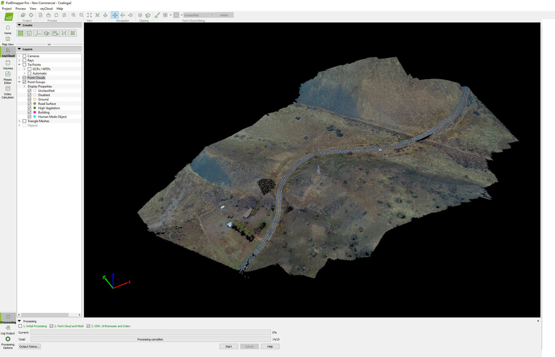
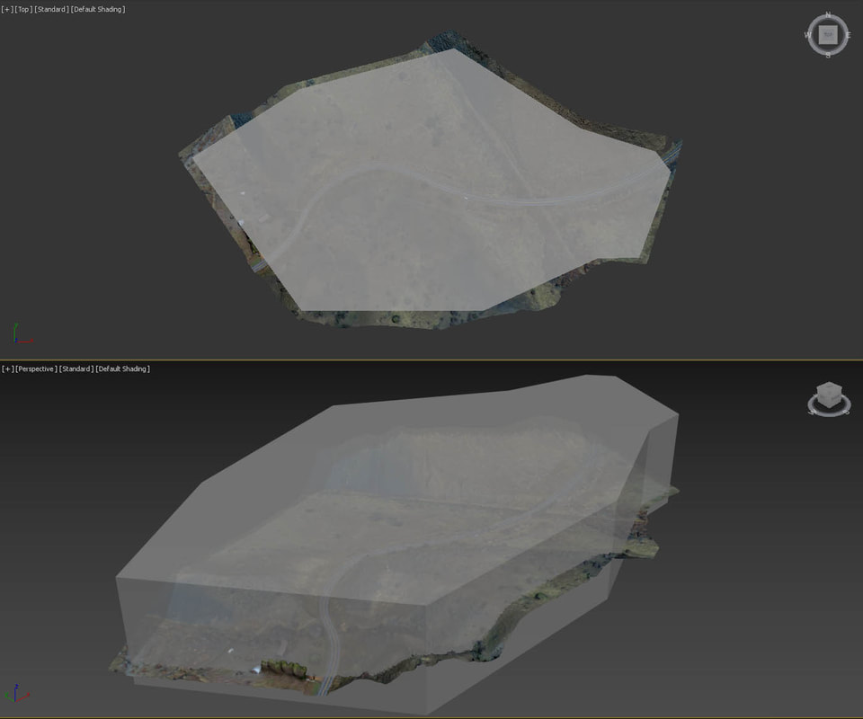
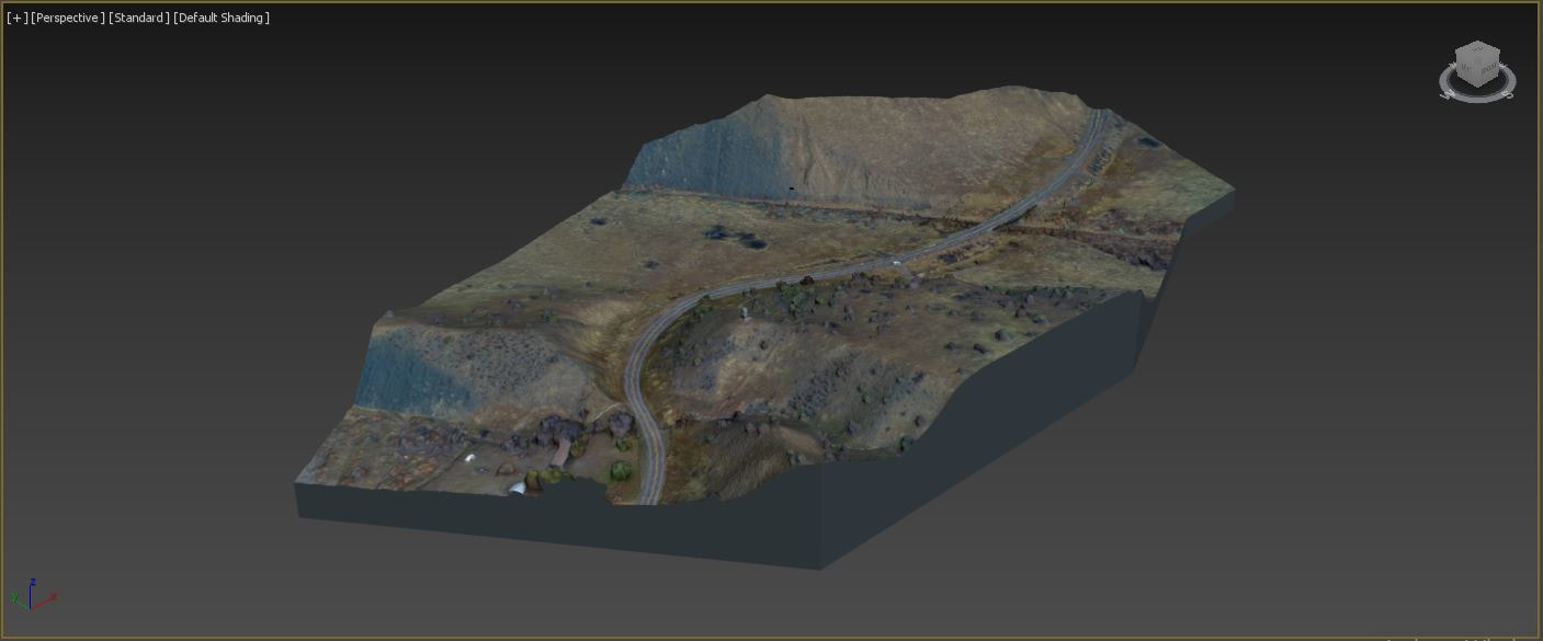
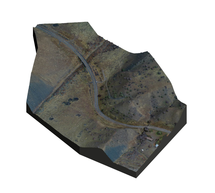
ABOVE is a typical scene generated from 362 images. This case involves a collision at a curve between a big rig and a motorcycle. Certainly the ORTHOGRAPHIC IMAGE I generate will be useful to my client, but selling scaled ortho imagery isn't going to provide me with the lifestyle I want to enjoy. For my work product to be truly valuable, I need to deliver a good 3D scene that has some impact. To quote one of my favorite clients from Georgia, "it needs to have a little bit of Elvis in the mix."
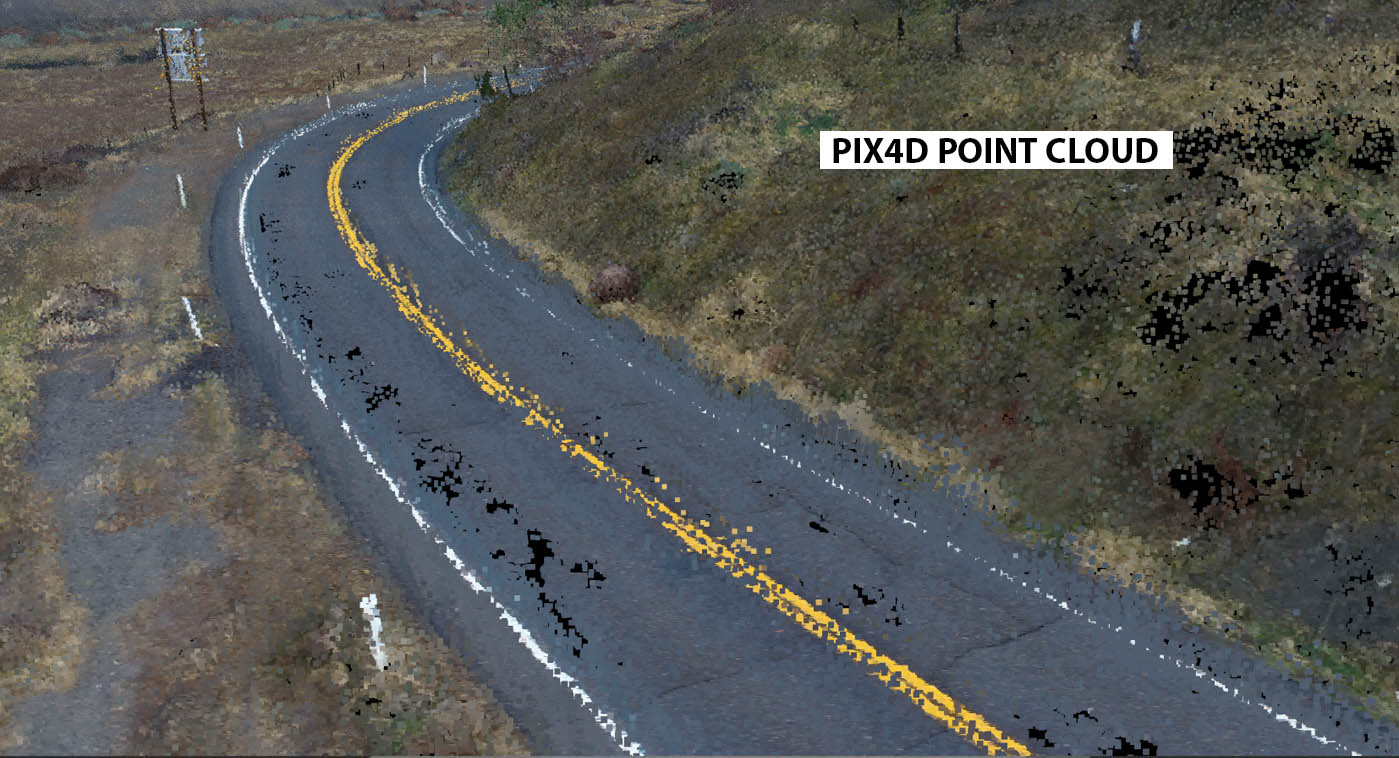
As beautiful as the screenshot of the PIX output is, there are some issues. When we move in close to the 3D point cloud we begin seeing something that looks more like George Seurat's pointillist painting A SUNDAY AFTERNOON:
ABOVE is a typical scene generated from 362 images. This case involves a collision at a curve between a big rig and a motorcycle. Certainly the ORTHOGRAPHIC IMAGE I generate will be useful to my client, but selling scaled ortho imagery isn't going to provide me with the lifestyle I want to enjoy. For my work product to be truly valuable, I need to deliver a good 3D scene that has some impact. To quote one of my favorite clients from Georgia, "it needs to have a little bit of Elvis in the mix."
As beautiful as the screenshot of the PIX output is, there are some issues. When we move in close to the 3D point cloud we begin seeing something that looks more like George Seurat's pointillist painting A SUNDAY AFTERNOON:
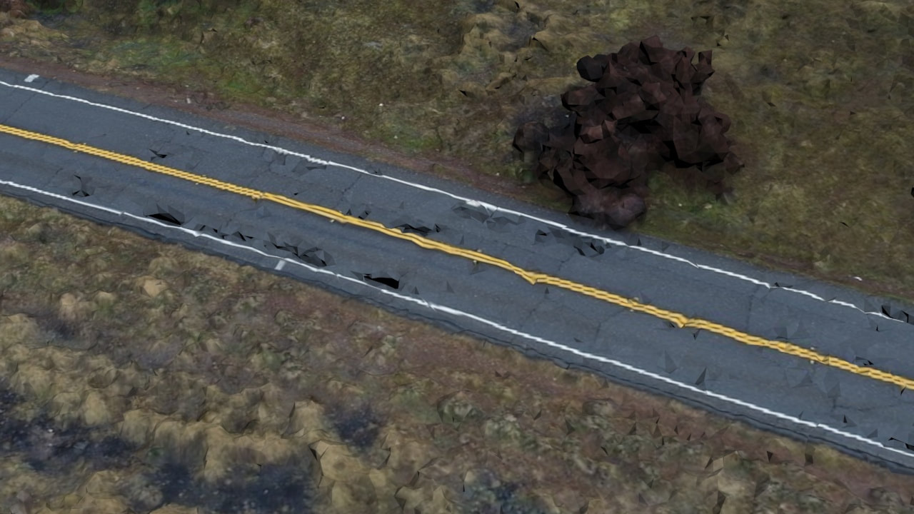
There are a lot of reasons we never use point clouds to produce our client deliverable work that I won't go into here. Suffice it to say that we ALWAYS work from a 3D mesh. And while PIX excels at producing a colorized 3D mesh, it also has some problems when you get down to close range. BELOW is the raw converted mesh and you can see the roadway looks horribly messed up and the foliage lacks detail:
Back in the old days before drone photogrammetry, we would build this 3D scene by hand using topographic surveys, aerial photographs and lots of ground-based references. Take it from me, this was a TEDIOUS process that required immense amounts of manpower and the results were highly dependent upon the skill of the 3D artists working on the project. Not surprisingly, the clients paid dearly (sometimes over $100,000 for major cases).
When you consider the context of the project, with often millions or tens of millions of dollars at stake, it makes perfect sense for a law firm to pay $25,000 or $50,000 for a tool that will either significantly increase the likelihood of a favorable verdict OR result in a significant increase in the amount of money awarded. Naturally, the insurance company or corporation on the other side of the case will be equally motivated to pay that amount for a presentation that significantly REDUCES the likelihood that they will get hit by a big verdict.
As I mentioned, every major urban courtroom has transportation case trials going on every day and every week. Lawyers are very good at paying attention to what works and what doesn't and collision scene animations have long been established as being effective and virtually necessary for lawyers handling major cases. Thus, in 2014, when I first used PIX4D, I recognized immediately that this was technology that would completely revolutionize my work.
We still do plenty of complex animation, but I can honestly say that our bread and butter work involves basic forensic visualization in transportation cases that DOES NOT require complex skills. I'm going to walk you through the steps that we used to turn this typical case into a valuable forensic tool:
CREATE A SIMPLE PRIMITIVE SHAPE WITHIN THE BOUNDARY OF THE 3D MESH:
The first thing we need to do is convert this raw mesh into a more substantial appearing model. To do this, I draw a simple spline outline and extrude the shape so that its top and bottom are above and below the terrain.
:
APPLY A SIMPLE BOOLEAN FUNCTION USING A "COOKIE_CUTTER" APPROACH:
APPLY A SIMPLE BOOLEAN FUNCTION USING A "COOKIE_CUTTER" APPROACH:
The boolean function cuts both shapes and when you delete the top portion you have a terrain with solid-looking sides.
As you can see ABOVE, the terrain appears now to be a solid block extracted from the earth. This simple technique immediately makes your terrain much more aesthetically pleasing (which is a major goal for any courtroom presentation).
REPLACING THE ROAD SURFACE
Anyone experienced with drone-based mapping quickly learns that it is difficult to obtain a smooth road surface when mapping an area of this size due to elevation noise. In theory, you could do extremely low-level flights along the center line of the roadway with oblique passes to remove the noise and, indeed, we have used this approach for roadway scenes covering a limited area. Even so, that approach requires sufficient roadway detail to generate enough tie points to create a reasonably smooth surface and you'll likely have problems due to the uniformity of the pavement making automatic registration problematical.
In this particular case, heavy showers were advancing so that we had to grab coverage and retreat without the level of road detail I would have preferred having. Portions of the road were so noisy that the resulting mesh looked like a wrinkled ribbon:
In this particular case, heavy showers were advancing so that we had to grab coverage and retreat without the level of road detail I would have preferred having. Portions of the road were so noisy that the resulting mesh looked like a wrinkled ribbon:
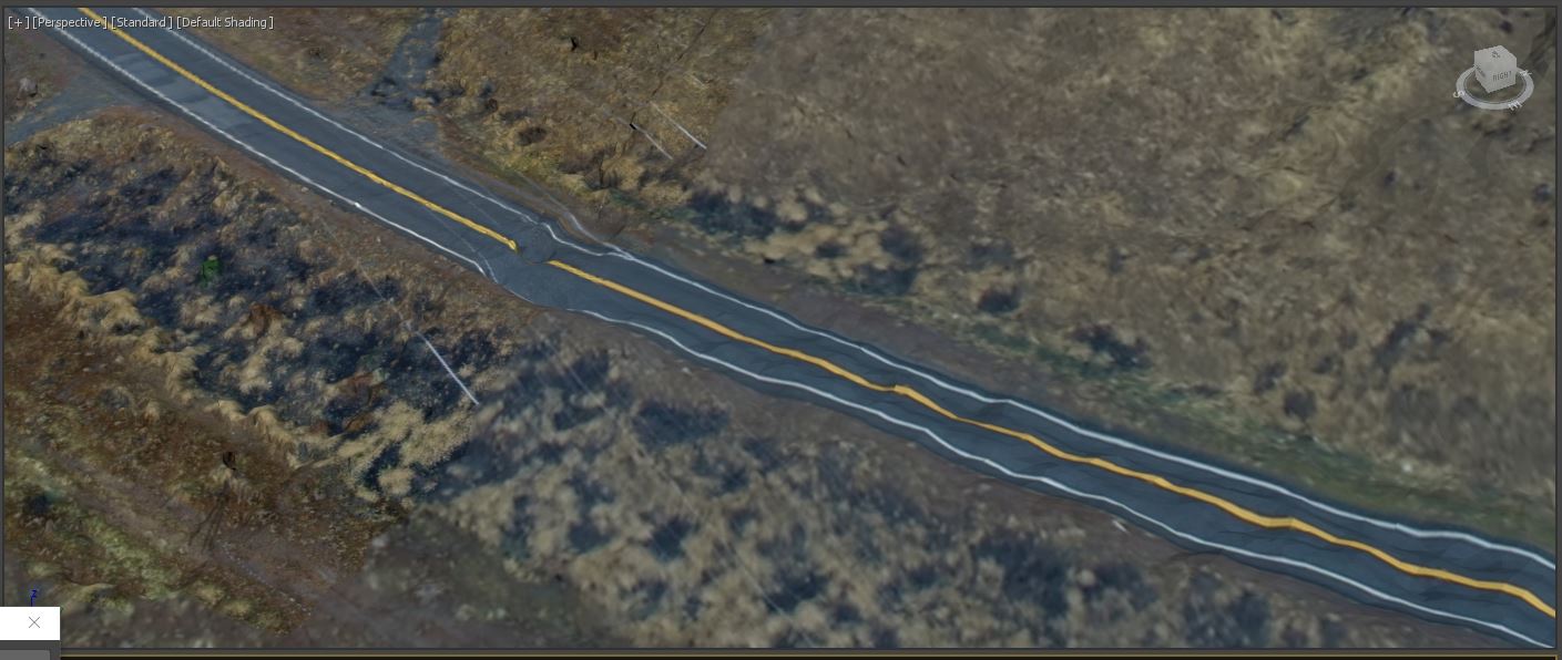
We've done enough of these cases now that we don't worry about the roadway and we simply replace it with a lofted spline. Our shop uses MAYA and 3DS MAX, but you can accomplish this with any professional-level 3D package.
To show this process I'll use 3DS MAX. I first import the FBX file from the PIX4D 3D mesh folder (BELOW):
To show this process I'll use 3DS MAX. I first import the FBX file from the PIX4D 3D mesh folder (BELOW):
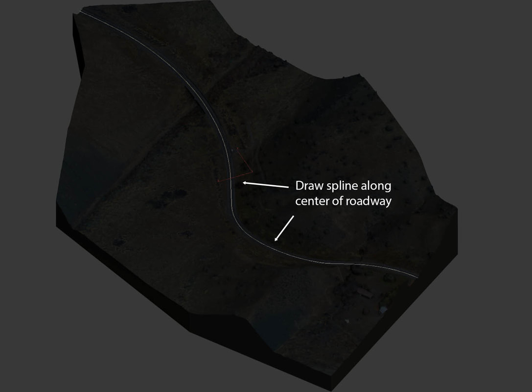
Next I simply draw a SPLINE CURVE along the center line of the roadway. Once the spline is drawn you should zoom in and adjust each bezier curve so that you have a nice smooth spline all along the roadway:
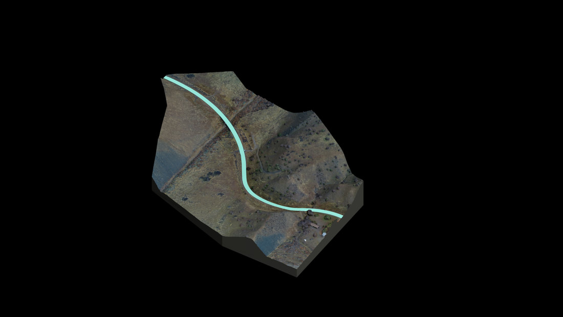
Now that the spline is positioned, you simply use a LOFT command to loft a simple roadway cross section the length of the path. This gives you a perfectly smooth road surface:
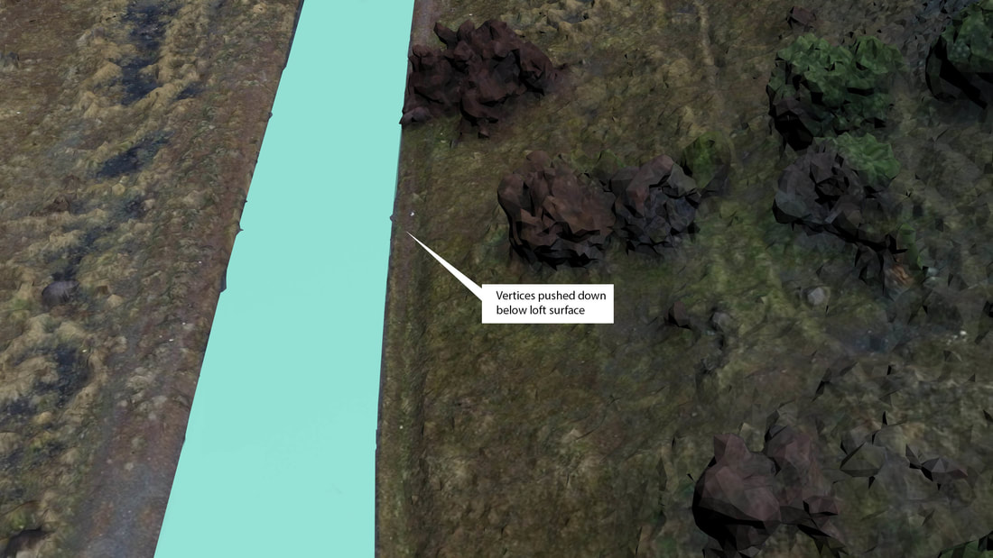
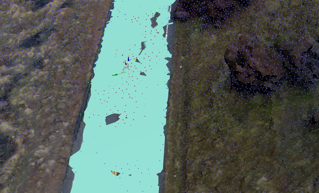
We need to zoom in to see where the old noisy road surface is poking up through the perfectly smooth loft. BELOW I have turned on the VERTEX feature and I've highlighted the vertices of the old roadway surface. I can now PUSH these old vertices down so they disappear beneath the new smooth loft surface.
BELOW the vertices have been pushed below the loft, leaving a nice smooth road surface: